Skip to content
Civilian Air Support · Beta sign-ups open

Draw it.
Hit Go.
Map in ATAK.

Outline the area on your phone. The drone flies the grid on its own, the map builds on the phone, and it drops into every teammate's ATAK. No stick time, no laptop, no one pulled off the line.

Android phone · DJI Mini 4 Pro + DJI RC-N3 · ATAK-CIV (free)

Animation of how it works. The imagery is real, from one of our test flights.
The problem

Eyes up.
No one pulled off the line.

A dedicated drone operator is a luxury a small team can't afford. On a squad of four, one person on the sticks is a quarter of your people.

TakVector flies the mission for you. Draw the area, hit Go, and the drone runs the grid on its own while the pilot keeps it in sight and stays on task. The map lands in ATAK for every member as soon as the drone is down.

All the eyes of a drone operator. None of the headcount.
How it works

Three steps. One map. Whole team.

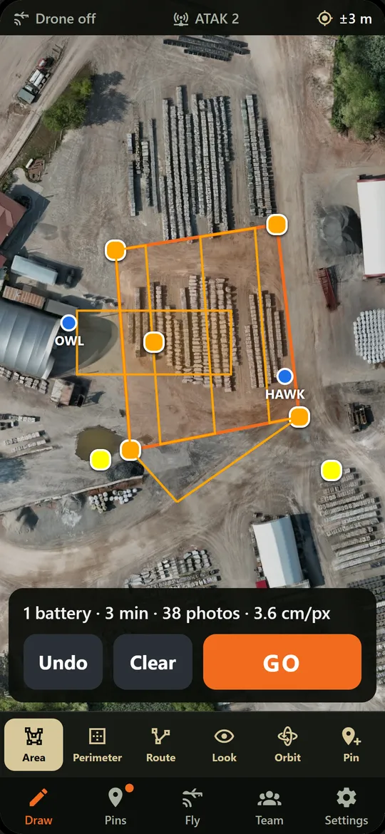
Phone screen: an area outlined on an aerial photo with planned flight lines and '1 battery, 3 min, 38 photos'.

01 Draw the area

Tap the corners. The app works out height, overlap, photos and batteries. The shape you draw is the mission.

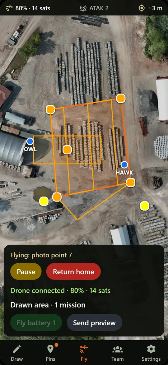
Phone screen mid-flight: 'Flying: photo point 7' with Pause and Return home buttons.

02 Hit Go

The drone flies the grid by itself. Pause or Return home is one tap. You keep eyes on it; your hands stay free.

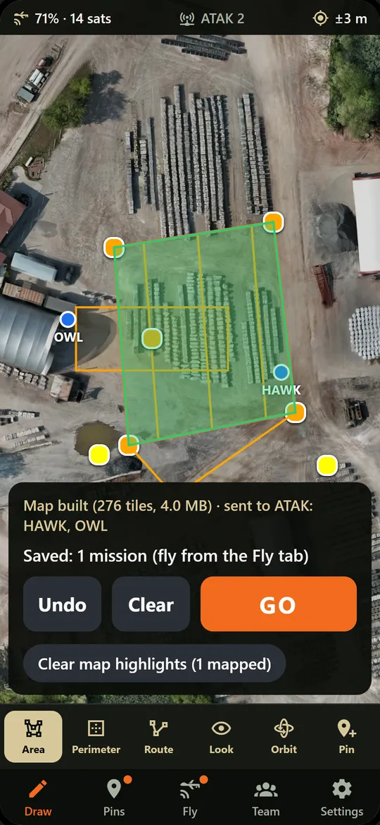
Phone screen: the area shaded green as mapped, with 'Map built, sent to ATAK: HAWK, OWL'.

03 Map in ATAK

The map is stitched on the phone, no signal needed, and pushed to every connected ATAK. Teammates don't need TakVector.

Real beta screens. The flight shown is simulated while flight testing finishes.

Six ways to task it

The shape is the order.

Draw in the TakVector app, or send a shape to the "Vector" contact straight from ATAK. Both drive the same drone.

Polygon

Area

Flies a mapping grid over the area and builds a stitched map on your phone, then pushes it to ATAK.

Area edge

Perimeter

Flies the outline of an area, inside or outside the line, with the camera looking down, ahead, in or out.

Line

Route

Scouts along a trail or road, following the bends, out to a distance limit, with an optional return the same way.

Point

Look

"Go look at that thing over there." A close photo and a wide photo, straight down, attached to the point.

Point or circle

Orbit

Circles a point of interest and attaches the photos to the marker in ATAK.

Marker

Pin

Drop rally points and markers that every teammate sees, then task the drone on any of them.

A different tool for a different team

Built for the squad, not the agency.

Enterprise drone systemsTakVector
AirframeEnterprise dronesSub-250 g consumer drone (Mini 4 Pro)
Runs onDedicated controllers, servers, laptopsThe phone already on your kit
CrewA pilot plus a payload operatorSmall team, or a single operator
WorkloadHands-on stick time, full attentionDraw, hit Go, keep eyes on; the app flies
MappingSeparate mapping softwareAutomatic: the map is pushed to ATAK
Where it stands

Building in public. No fake footage.

Beta sign-ups open. The first flight tests are underway; testers get access as soon as missions fly end to end.

  • Vector shows up as a contact in ATAK, and a marker sent to it comes back as an orbit path and photos (tested on a Galaxy S23).
  • Maps built on the phone from real drone photos, aligned to within about 20 cm photo to photo, and displayed in ATAK.
  • Finished maps delivered into ATAK hands-free, confirmed in chat. No taps.
  • DJI's developer kit connected to the Mini 4 Pro and RC-N3 from our own app.
  • Mission planning runs on the phone and works with no signal.
Beta

Get on the tester list.

10 to 20 testers before we charge anyone. Free through the beta, a discounted first year, and your name in the credits.

You'll need: Android phone, DJI Mini 4 Pro with the DJI RC-N3 controller (or plans to get one), and some time in ATAK.